The hiking bit
On to part 2 of my recent trip to North Wales, and this time amigos, we’re talking hiking – specifically, a hike over the hills that form the imposing backdrop to Barmouth and which offer an incredible view of Cardigan Bay, on a good day.
My original intention was to follow a designated route to the peak of Dinas Oleu (which translates enticingly as Fortress of Light), a modest, but very steep climb of just over 200 m (650 ft). Interestingly I learnt that Dinas Oleu was the first area of land donated to the National Trust, in 1895, and that there’s a monument to mark the NT’s centenary about half way along the trail. The route also takes in the remains of an Iron Age enclosure and a local landmark known as Frenchman’s Grave – the resting place of a French philosopher who settled in Barmouth after fleeing Paris during the Franco-Prussian War. However… was the route easy to follow? No, no it wasn’t. It was outlined on the National Trust website and the detail was both scant and unclear and meant that I missed out on both of the latter two features I mentioned above. Nevertheless, once I’d realised I was off-track I decided just to follow my nose and keep walking along one of the many well-trodden paths that criss-cross the hills.
I’ve been to Barmouth many, many times over the years, and I like to think I know it quite well. But once I’d begun to wander beyond the typical holiday-makers’ haunts it all became rather fresh and unfamiliar, as though I were discovering the town for the first time. The early part of the route, beginning in the town itself, was quite well-described and took me through some quaint little back-streets, although at times I did begin to wonder whether I’d strayed unknowingly into someone’s garden. Pretty quickly though, I found myself on a narrow, grassy path which followed the contours of the hill that backs onto the town. Narrow is the pertinent word, here. It was wide enough only for single-file passage, and it sloped – not up or down in the direction I was walking, of course not, but unnervingly – sideways, as though I were being marshalled slowly but surely to my doom, beyond the perilous edge where the hillside fell away at an unspeakably precipitous angle towards the town far below. I steadied myself with one hand against the near-vertical grassy slope to my right, for the whole length of the path, sweating like a turkey at Christmas.
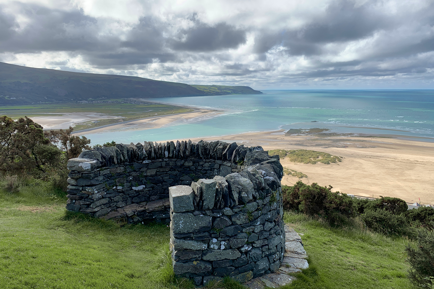
After a while the path turned back towards the summit, and the gradient eased somewhat, before I arrived at the viewing point and National Trust centennial monument, which seemed like a fitting spot to take a break and a few well-earned slugs of water. A couple of sprightly septuagenarians yomped past while I was rehydrating and catching my breath, and took great pleasure in pointing out how much fitter than them I should have been. I mean… the nerve! Off they strolled, chuckling like two spring chickens as they went.
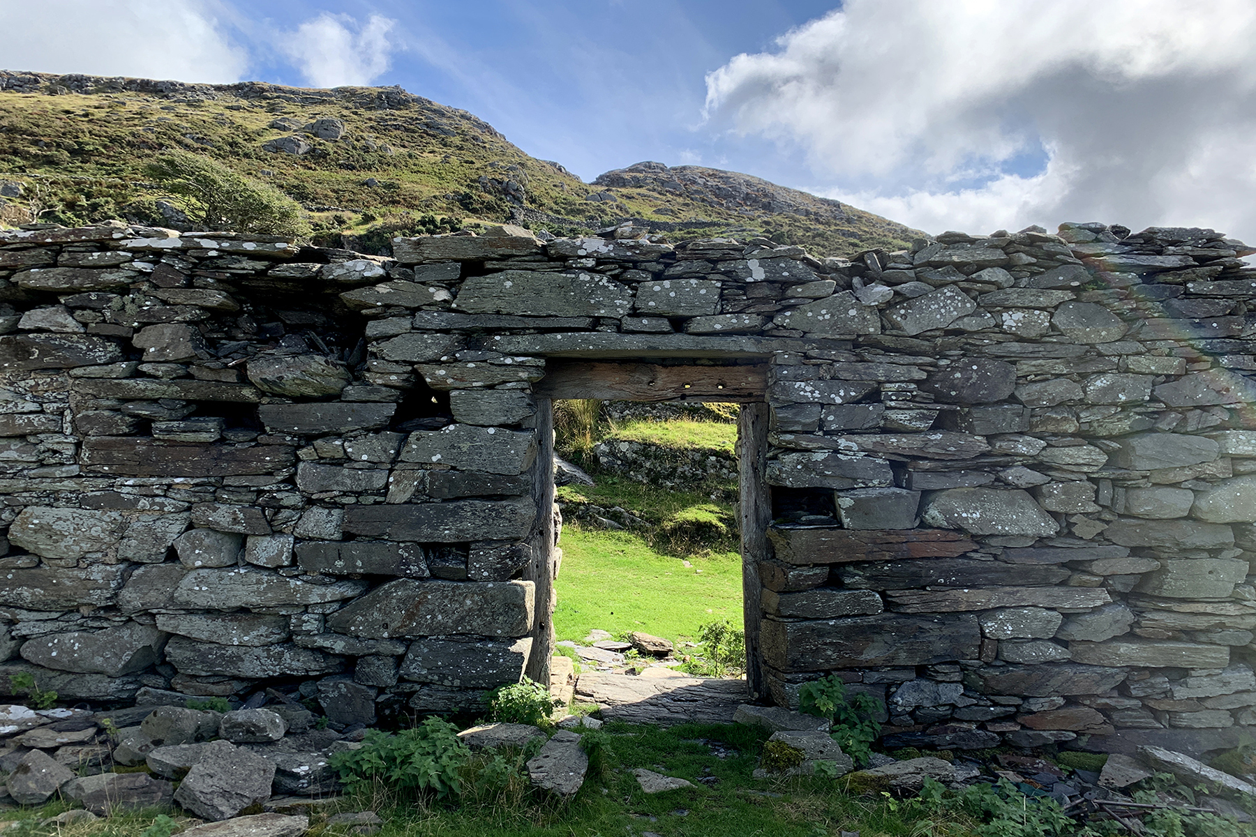
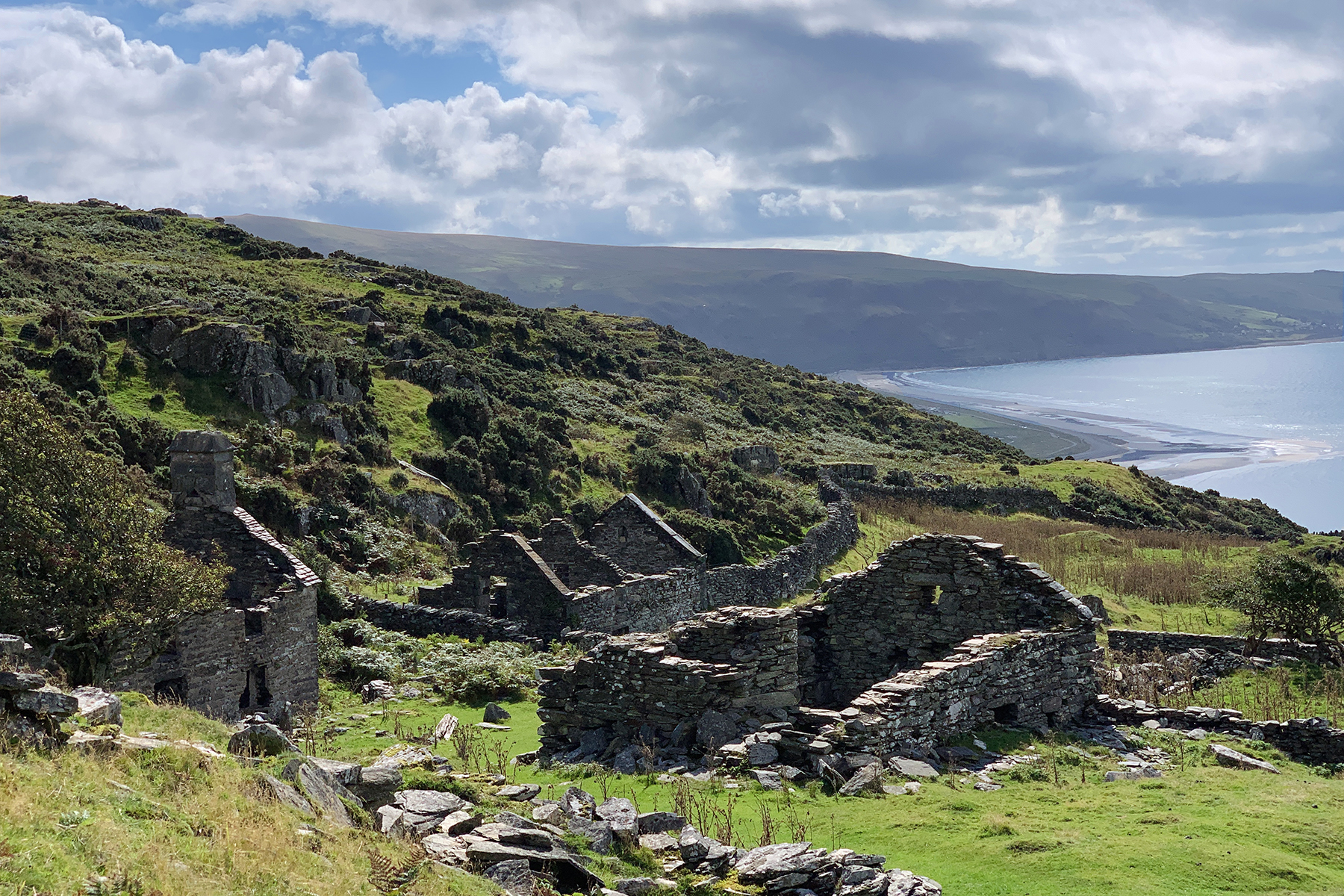
Water levels replenished, and strength regained I made my way onwards and as the morning got ever sunnier I came to a place called Gellfechan or Cell-fechan (meaning small cell) – the ruins of an old farmstead, high and isolated on the grassy uplands. This was easily the highlight of my hike – I had no prior knowledge that it even existed and so its discovery was naturally a complete surprise. The site comprises the main farmhouse, and several barns and outbuildings, their crumbling, grey stone remains, intricately adorned with mosses and lichens. Notwithstanding the inevitable poignancy that always seems to accompany the ruins of old buildings, it really is a beautiful place, and given its fairly remote situation I imagine it’s not particularly well-known. It was still in use up until the 1950s, but you’d be forgiven for thinking it had been abandoned long before that, given how its exposed location has left it at the mercy of the elements, I suppose.
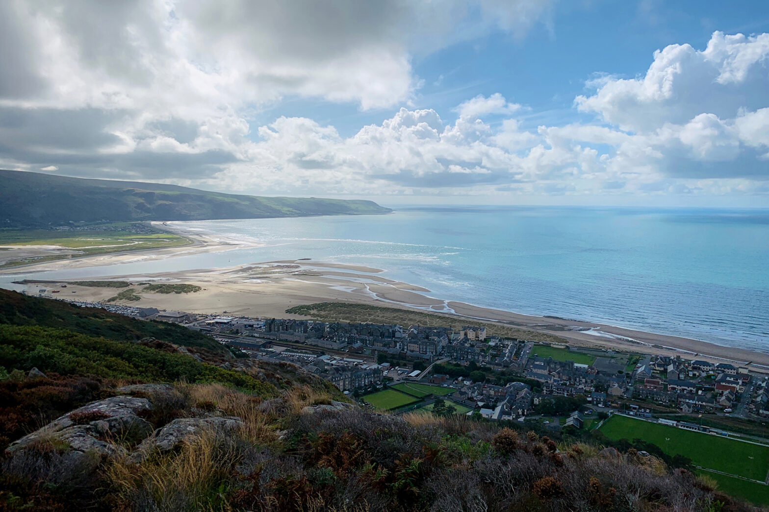
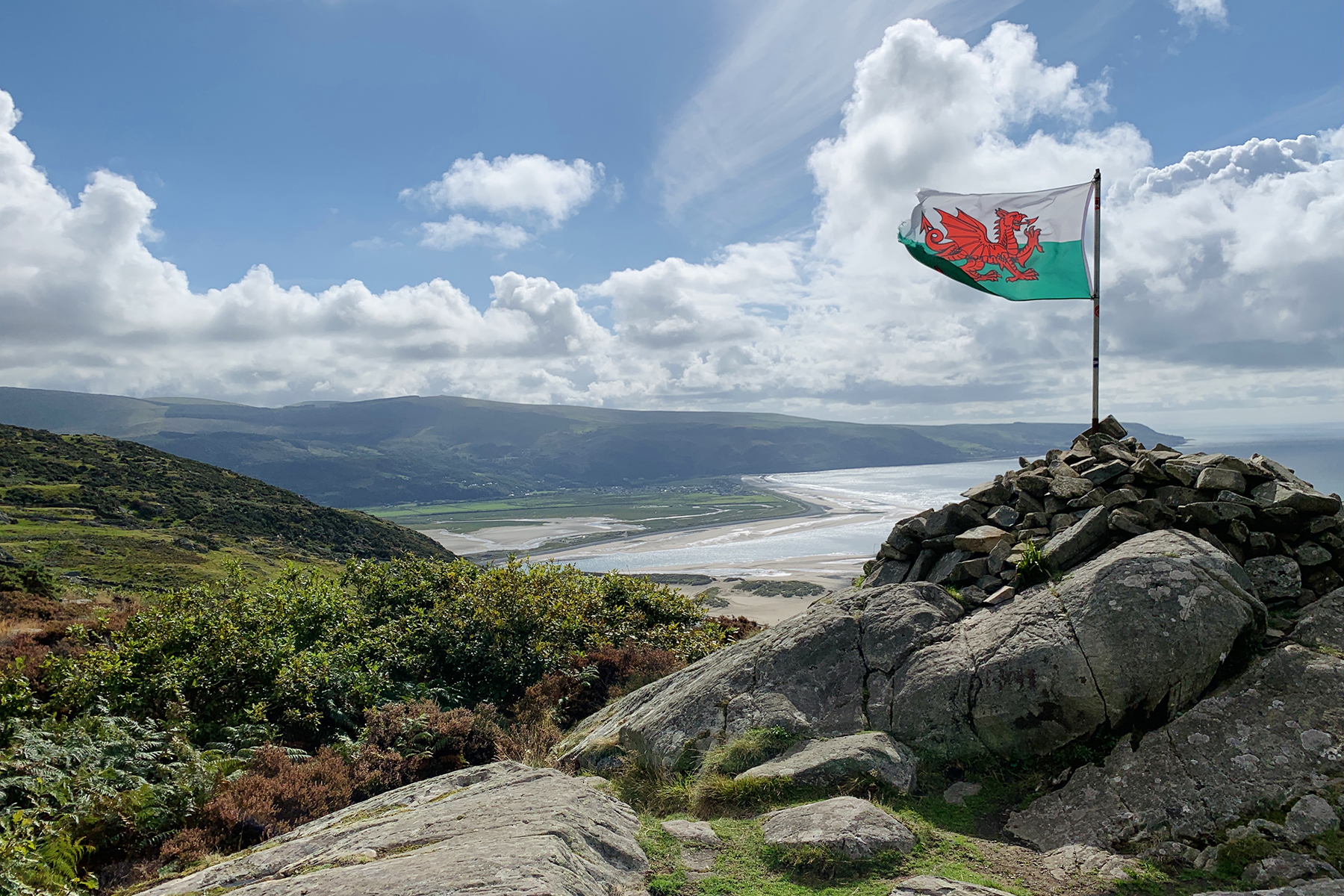
Two satsumas, an egg and cress sandwich and half a bottle of water later I was on my merry way, bound for what I’d now decided would be the end point of my walk, Raven Rock, or Craig y Gigfran – the rocky peak of one of the hills above the town, visible from Gellfechan, and proudly surmounted by the Welsh flag. The sight will no doubt be familiar to those in the town far below, as the flag can be seen fluttering way off in the distance, from the promenade. The path to the peak passes through a small, dense wood, perfectly navigable for people under three feet tall, not so much for anyone else. I almost lost an eye – an eye, I tell you – on several occasions, such was the incessant poking and prodding of branches, strategically positioned at just the right (or wrong) height and angle. Undaunted however, and like an ersatz Bilbo Baggins, I soon emerged from Wales’ own Mirkwood into the light, and the town and the great vista of Cardigan Bay spread out before me. A breathtaking view. The sun was high by now and the sky a juicy Capri blue, flecked with candy-floss clouds. An unbroken expanse of sumptuous turquoise sea stretched from Cae Du in the south to Morfa Dyffryn in the north, and ahead to the north-west and the curl of the Llŷn Peninsula.
I set up my Mamiya C330 to take a few shots on film and, as always, I took a huge amount of pleasure and found great calm in the slow, meticulous process of manual film photography. The results aren’t really worth showing here in all honesty – I nailed all the technical settings, but the composition was a bit ordinary – however the process was good for the soul, man! A few other hikers arrived at the summit while I was there, and much to my dismay not one of the incurious bunch asked about my awesome looking camera, which I was dying to show off 😉 but we chatted amicably and ooh-ed and aah-ed about things like the weather and the view instead, which was almost as enjoyable. The shots in this post were all taken with my iPhone, and I’m quite happy enough with them.
And that’s it. I retraced my steps and headed back past Gellfechan where I stopped to take a few more photos, then made my way back down to the town, somehow managing to take the wrong path… I couldn’t go too far wrong though, as long as I kept heading in a generally downward direction! So thus, I still ended up back where I’d started, wondered along the promenade in the afternoon sun and grabbed myself a colossal hot dog for lunch, from the Bath House Café, which was always my intention. Good times!